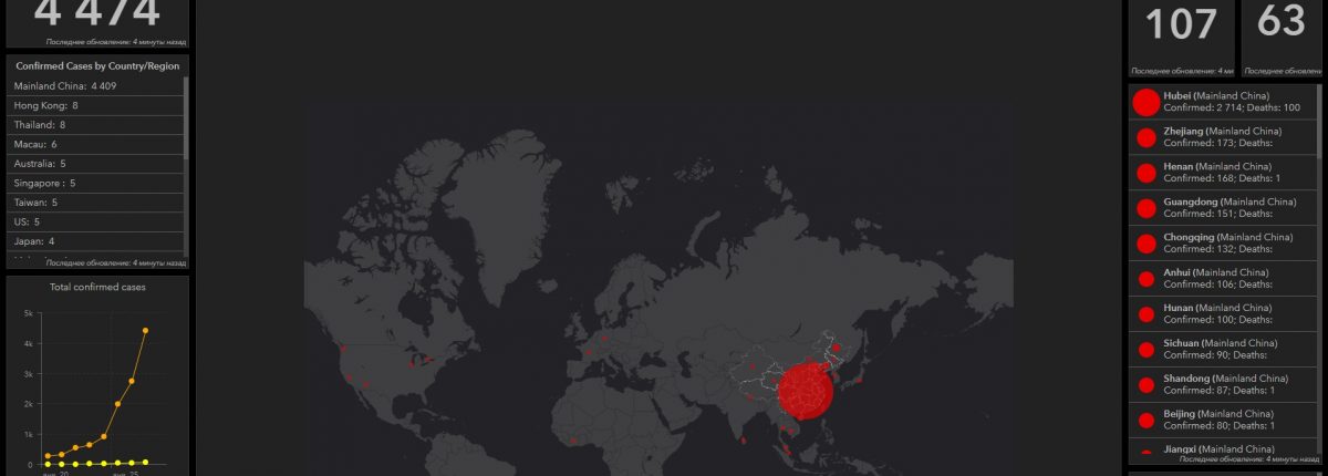
The death toll from the coronavirus, which originated in the city of Wuhan, China, has reached at least 107, with more than 4,400 infected.
The map, compiled by researchers at Johns Hopkins University, tracks and visualizes outbreak reports using data from the Centers for Disease Control and Prevention, the World Health Organization, China CDC and other sources with geographic information system mapping.
As reports come in, the map shows the total number of confirmed cases, the total number of deaths and the total number of cured. Each red dot represents a disease outbreak. When pressed, information about the region is displayed.
In the panic and confusion common during an epidemic, false information can spread quickly. In addition to the confusion, China seems to have hidden information about the disease in the early days.
At least eight people were arrested in China on charges of “posting or sending false information online without verification” about the coronavirus. Journalists reported that they were threatened and detained after reporting on the virus.
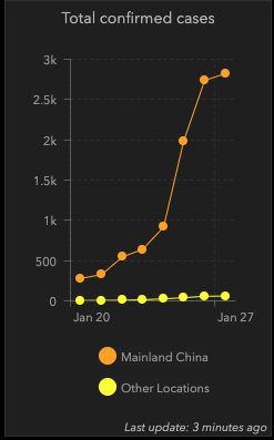
The chart shows how quickly the virus spread in mainland China compared to the rest of the world.

To date, the virus has spread to 13 other countries, including the United States, France, Australia and Japan.
Experts expect the true number of infected people to far exceed official figures.
While health officials said they believed the coronavirus would be weaker than SARS, Wuhan has been quarantined and travel restrictions have been imposed in at least 12 other cities, affecting about 33 million people.
Real-time distribution map of the Chinese coronavirus.


